Central Question
How does East African history change when port cities, inland trade, colonial coercion, anti-colonial resistance, and postcolonial development are read as one route?
Start With These Dates
- c. 900 CESwahili Coast City-States Rise
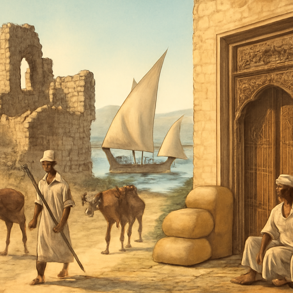
Swahili-speaking coastal towns grew into Indian Ocean commercial centers, linking African producers, Muslim merchants, monsoon shipping, coral-stone cities, and inland trade routes.
- c. 1200 CEKilwa Sultanate Flourishes
Kilwa became one of the most influential Swahili city-states, mediating gold, ivory, ceramics, cloth, and Islamic prestige between inland routes and Indian Ocean ports.
- c. 1250 CEGreat Zimbabwe Flourishes
Great Zimbabwe reached a high point as a stone-built political and commercial center connected to cattle wealth, gold routes, regional authority, and Indian Ocean trade.
- 1331 CEIbn Battuta Visits Kilwa
Ibn Battuta's visit to Kilwa placed the Swahili Coast inside a written travel route that connected Morocco, Arabia, East Africa, India, and wider Islamic networks.
- 1698 CEOman Expels Portuguese from Mombasa
Omani forces took Fort Jesus at Mombasa after a long struggle, weakening Portuguese influence and shifting the Swahili Coast toward Omani-linked power.
- December 9, 1961Tanganyika Gains Independence
Tanganyika became independent from British rule, with Julius Nyerere and TANU turning nationalist organization into a new East African state.
- 1967 CEArusha Declaration
Tanzania's Arusha Declaration set out a socialist and self-reliance program that linked rural development, public ownership, equality, and postcolonial legitimacy.
Sources Used Here
- Encyclopaedia Britannica: Kilwa
Reference for Kilwa as a Swahili city-state, commercial center, Portuguese occupation, and later decline.
- Official UNESCO World Heritage Centre: Ruins of Kilwa Kisiwani and Songo Mnara
Reference for the material remains and Indian Ocean setting of Kilwa and Songo Mnara.
- Encyclopaedia Britannica: Zanzibar
Reference for Zanzibar's Indian Ocean position, port economy, and later clove-export history.
- Official UNESCO World Heritage Centre: Stone Town of Zanzibar
Reference for Stone Town as an Indian Ocean Swahili trading center shaped by maritime commerce and cultural exchange.
- Encyclopaedia Britannica: Maji Maji
Reference for the 1905-1907 uprising against German colonial rule in East Africa.
Swahili Coast and East Africa is designed as a route, not a folder. It gathers events that answer related reader questions about power, belief, conflict, exchange, institutions, and memory. The strongest way to read the page is to move from the earliest events toward the later ones, watching how one kind of pressure changes form across different places.
The route currently runs from c. 900 CE to 1967 CE. That span lets readers compare immediate turning points with slower consequences: the founding of institutions, the spread of ideas, the shock of war or disease, and the way later societies reused earlier events as warnings, models, or symbols.
Start with Swahili Coast City-States Rise, Kilwa Sultanate Flourishes, Great Zimbabwe Flourishes, Ibn Battuta Visits Kilwa, Portuguese Capture Kilwa and then follow the internal links into people, timelines, years, maps, and source lists. The route structure stays visible when each event explains why it belongs with the others and where the next useful page is.
Compare the events by scale. Some are concentrated moments, such as a battle, proclamation, trial, or publication. Others are long processes, such as a reform movement, pandemic, trade route, or diplomatic order. Reading both types together helps prevent the page from becoming a list of dates.
A useful route keeps uncertainty visible. Historical change rarely has one cause or one clean ending, so the reader can separate background pressure, immediate trigger, turning point, result, and later memory. That pattern is what makes the atlas expandable without making the reader start over each time.
This route is also a comparison tool. After reading one event, compare it with a later event on the same page and ask what changed in scale, language, geography, technology, authority, or public memory. The comparison is often more useful than the individual summary because it reveals the pattern the topic page is built to expose. When a claim feels too neat, open the full event page and check whether the evidence supports one cause, several causes, or a contested interpretation before moving on.
This route keeps East Africa visible before, during, and after European empire. The Swahili Coast pages begin with African port cities and Indian Ocean trade because East African history does not start with colonial arrival. Kilwa, Mombasa, Zanzibar, Great Zimbabwe, and inland routes show African, Arab, Persian, Indian, and local networks making wealth, language, religious life, and political authority across the monsoon world.
The middle of the route turns connection into conflict. Portuguese attacks, Omani power, Zanzibar's clove economy, and German East Africa reveal that oceanic trade could become armed control, plantation labor, and colonial extraction. Maji Maji then changes the lens from port wealth to rural coercion. Cotton, forced labor, land, prophecy, famine, and colonial retaliation show how imperial rule reached ordinary communities far from the coast.
The modern section follows independence into state-building. Tanganyika's independence and the Arusha Declaration show that sovereignty was not the endpoint. Julius Nyerere's Tanzania tried to turn independence into social equality, rural development, Swahili language politics, and a postcolonial model of self-reliance. Readers can therefore move from medieval port cities to postcolonial development without losing the route's central question: who controls movement, labor, land, and public authority?
A strong East Africa route begins with geography. Monsoon winds, islands, reefs, harbors, caravan paths, highland edges, goldfields, ivory routes, clove plantations, and inland food systems all shaped what coastal power could do. Kilwa's wealth depended on routes that reached inland producers and external buyers. Zanzibar's nineteenth-century rise depended on plantations, enslaved labor, Omani politics, and Indian Ocean demand. The map is not decoration; it explains why some places became brokers and others became extraction zones.
Swahili history also resists a simple outside-in narrative. Islam, Arabic literacy, Indian Ocean commerce, stone architecture, local African languages, and kinship networks did not erase local agency. Coastal elites adopted and adapted wider oceanic forms to make authority legible to merchants, visitors, and neighbors. Ibn Battuta's Kilwa is useful because it gives readers a scene of prestige and connection, but the deeper story is the work of communities building urban life around trade, faith, and local power.
Great Zimbabwe widens the route beyond the shore. Its inclusion prevents the coast from looking self-sufficient. Inland states, cattle wealth, gold production, craft, settlement organization, and political authority helped feed oceanic commerce. Reading Great Zimbabwe beside Kilwa teaches a larger lesson: port cities become powerful when they translate inland resources into long-distance exchange, and inland societies are not passive suppliers in someone else's maritime story.
The Portuguese capture of Kilwa and later Omani expulsion of the Portuguese from Mombasa give the route a useful sequence. European naval violence did not permanently define the coast, and Omani power was not a return to an untouched past. Each shift changed customs, forts, diplomatic relationships, taxation, plantations, and labor. East African history becomes richer when power is read as a series of negotiated and coercive regimes rather than as one colonial takeover.
Maji Maji is the route's moral and political hinge. It moves the reader away from merchant wealth and toward colonial demand on rural communities. German rule tried to make labor, crops, taxes, and obedience measurable. Resistance drew on local grievances and spiritual authority, and the repression produced famine and trauma. This episode reveals how empire entered fields, bodies, and food supply, not only ports and capitals.
Independence in 1961 gives the route a second hinge. The end of British rule did not answer how a new state would handle language, education, rural poverty, regional identity, and development. The Arusha Declaration turns those questions into policy and ideology. Ujamaa was not simply a slogan; it was an attempt to build a social order around villages, public ownership, equality claims, and national self-reliance, with real ambitions and real costs.
The route's reader payoff is that East Africa becomes a full historical system. It has medieval cities, inland states, Indian Ocean links, Islamic and African urban cultures, plantation economies, anti-colonial violence, language politics, socialism, development debate, and memory. That breadth makes the hub useful for searches about the Swahili Coast, Kilwa, Zanzibar, Maji Maji, Tanganyika, and Tanzania without splitting them into disconnected fragments.
Language gives the route another kind of continuity. Swahili was not only a medium of trade; it became a way to connect towns, religious learning, poetry, contracts, migration, colonial administration, and later national politics. In Tanzania, Swahili became part of state-building because language could help bridge regional difference and make citizenship feel shared. That makes language a historical institution rather than a cultural detail.
The hub also separates commerce from equality. Indian Ocean trade could create wealth, cosmopolitan culture, and urban prestige, but it could also depend on enslaved labor, debt, hierarchy, and coercion. Zanzibar's clove economy makes that tension visible. Plantations tied global demand to local violence, while merchants, rulers, laborers, and captives experienced the same oceanic system from sharply different positions.
Religion in this route moves through mosques, scholars, pilgrimage, kinship, commercial trust, and urban identity. Islam on the coast did not erase African belonging; it gave many communities another language for authority, literacy, law, and connection across the ocean. The route works best when readers treat religion as lived social infrastructure, not as a simple import from somewhere else.
A reader also needs to watch scale change. Kilwa and Mombasa show city-scale politics; Great Zimbabwe shows inland state formation; Zanzibar shows plantation and sultanate power; German East Africa shows colonial territorial rule; Tanganyika shows national sovereignty. Moving across those scales helps explain why East African history cannot be reduced to one coastline, one empire, or one independence date.
Memory changes the later route. Maji Maji is remembered not only as a rebellion but as a symbol of anti-colonial sacrifice and the violence of forced rule. Ujamaa is remembered both as a hopeful attempt at equality and as a contested policy with coercive elements and economic limits. The page keeps both memory and policy visible so readers can ask how later nations use the past to explain themselves.
The strongest comparison is with other oceanic hubs. The Indian Ocean, maritime Southeast Asia, and Atlantic routes all involve ports, ships, labor, religion, and empire, but they do not work the same way. East Africa brings inland routes, Swahili urban culture, Omani and Portuguese rivalry, German colonialism, and Tanzanian socialism into that wider comparison. That gives the atlas more than a coastal summary; it gives readers a world-history comparison tool.
For students, the route answers a common question: why did the Swahili Coast matter? The answer is not simply trade. It mattered because ports translated geography into political power, because inland regions and oceanic merchants depended on one another, because colonial regimes tried to capture that movement, and because postcolonial Tanzania later tried to turn a regional language and rural policy into national identity.
The final reading move is to keep affected communities in the foreground. Stone towns, plantations, caravan roads, villages, colonial offices, schools, and postcolonial villages were inhabited by people making choices under pressure. The hub becomes memorable when readers can see merchants negotiating trust, farmers facing forced cultivation, captives moving through plantation systems, rebels risking retaliation, and citizens debating what independence had to deliver.
The source trail also changes the reader's confidence. Archaeology and UNESCO heritage records help ground Kilwa and Great Zimbabwe in built landscapes. Travel accounts such as Ibn Battuta's give vivid outside impressions, but they need to be read beside local material evidence and later scholarship. Colonial records can show policy and violence while also carrying the biases of officials. Postcolonial documents reveal state ambition, but not always how villagers experienced policy.
East Africa's route also connects to climate and ecology. Monsoon timing, agricultural zones, drought, famine, clove cultivation, cattle economies, and food supply shaped trade and coercion. Maji Maji becomes clearer when environmental stress and forced cotton cultivation sit beside military repression. Arusha becomes clearer when rural development is read as a wager on land, production, settlement, and social planning.
The comparison with Atlantic slavery and Indian Ocean exchange matters because coercion did not have one form. Enslavement, plantation labor, forced crop production, taxation, military violence, and colonial work regimes each changed lives differently. The route lets readers compare these forms without pretending that all unfree labor was identical.
The route also gives visual material a job. Ruins, carved doors, coral-stone architecture, manuscripts, maps, plantation landscapes, and colonial photographs can help readers see how oceanic exchange became built environment. A good image on this hub is not decoration; it tells readers whether they are looking at urban trade, sacred authority, labor, resistance, or postcolonial planning.
That visual rule matters because East Africa is often reduced to empty coastline on world maps. The hub asks images and maps to restore density: towns, routes, labor systems, farms, mosques, markets, schools, archives, plantations, and postcolonial villages. Readers need that density to understand why the region shaped wider Indian Ocean and African history, and why its inland connections clearly mattered as much as its coast and later national memory as well.
The Swahili Coast route is strongest when it begins with coastal cities rather than treating East Africa as a corridor for outsiders. Kilwa, Mombasa, Zanzibar, caravan routes, stone houses, mosques, carved doors, coinage, coral architecture, and monsoon sailing show societies that were locally rooted and ocean-facing at the same time.
Indian Ocean exchange did not erase African agency. Merchants, sailors, translators, rulers, farmers, enslaved people, artisans, caravan leaders, and religious scholars all shaped how goods and ideas moved between coast and interior. Portuguese and Omani rivalry mattered, but the hub stays richer when older Swahili institutions and inland networks remain visible before colonial conquest.
Zanzibar, Maji Maji, Tanganyika independence, and ujamaa give the route a long modern arc. Clove plantations, slavery, anti-colonial revolt, German and British rule, nationalist organizing, and Nyerere's state-building all connect coastal exchange to inland politics. East Africa becomes more readable when ocean history, labor coercion, and postcolonial development are seen as one route rather than separate subjects.
Read the events in order first; the page is built to reveal change over time.
Ask which pressures existed before the visible turning point and which actors had room to choose.
Follow what changed afterward in institutions, borders, law, belief, or everyday life.
Notice which events became symbols and why later generations kept returning to them.
Track how coastal cities depended on inland gold, ivory, food, labor, and political relationships rather than on ships alone.
Read Zanzibar, German East Africa, and Maji Maji through plantation work, forced cultivation, taxation, and resistance.
Use Tanganyika and Arusha to ask how a new state tried to convert independence into social policy and national identity.
Follow winds, harbors, merchants, pilots, languages, and trust networks as infrastructure for power.
Place Great Zimbabwe and interior routes beside Kilwa and Zanzibar so coastal history does not float without land behind it.
Follow dhows, caravan paths, ports, plantations, and inland political movements together instead of isolating the coast from East African history.
Choose a Reading Path
Start With the Timeline
Use the related timeline first when you want a chronological route through the topic.
Start with c. 900 CE: Swahili Coast City-States RiseOpen a Person Page
Use people pages when the topic is easier to understand through leadership, resistance, reform, or memory.
Start with c. 1200 CE: Kilwa Sultanate FlourishesUse Year Pages
Use year pages when you need a fast answer to what changed in a specific year.
Start with c. 1250 CE: Great Zimbabwe FlourishesReturn to the Map
Use the map to keep geography visible while moving between events and regions.
Start with 1331 CE: Ibn Battuta Visits KilwaNeed the Swahili Coast
Start with Swahili city-states, Kilwa, Ibn Battuta, and Portuguese Kilwa to see port power before modern colonial borders.
Start with 1698 CE: Oman Expels Portuguese from MombasaNeed Inland Africa
Read Great Zimbabwe beside Kilwa to connect gold, cattle, settlement, craft, and inland authority with oceanic exchange.
Start with December 9, 1961: Tanganyika Gains IndependenceNeed Colonial Rule
Move through Zanzibar, German East Africa, and Maji Maji to follow plantation labor, forced cultivation, taxation, and resistance.
Start with 1967 CE: Arusha DeclarationNeed Tanzania
Use Tanganyika independence and Arusha for questions about Swahili language, socialism, rural development, and postcolonial policy.
How the Story Builds
Begin with Swahili Coast City-States Rise. The opening event usually shows the pressure that made the route necessary: a crisis of authority, an expanding exchange system, a new technology, a contested idea, or a conflict that older institutions could no longer contain.
Oman Expels Portuguese from Mombasa works as a checkpoint because it lets readers ask what had become irreversible, which actors still had choices, and how the route changed scale between the opening event and the later consequences.
The later edge of the route includes Maji Maji Rebellion, Tanganyika Gains Independence, and Arusha Declaration. These pages help readers see what survived beyond the first shock: institutions, borders, laws, memories, technologies, movements, or arguments that kept shaping later history.
The route is easier to remember through people and places. Watch figures such as Swahili merchant communities, Kilwa sultans, Swahili merchants, Shona rulers, Gold traders, and Ibn Battuta move through settings such as East African coast, Kilwa Kisiwani, and Great Zimbabwe; that is where large structures become visible as choices, risks, costs, and memories.
Swahili city-states and Kilwa show urban life built from local African society, Islam, architecture, and Indian Ocean exchange.
Great Zimbabwe and caravan routes connect interior wealth and political authority to coastal brokerage.
Portuguese and Omani power turn trade routes into forts, customs, naval conflict, and changing forms of control.
German East Africa and Maji Maji show forced cultivation, taxation, spiritual resistance, famine, and violent repression.
Tanganyika and Arusha turn independence into a debate over equality, rural development, language, state power, and self-reliance.
- Which event in Swahili Coast and East Africa feels like the true point of no return, and why might another reader choose a different event?
- What changes if the route is read from the perspective of ordinary people rather than rulers, armies, inventors, reformers, or institutions?
- Which consequence was immediate, and which consequence only became clear decades later?
- Where does the map change the interpretation by showing distance, borders, routes, ports, capitals, or frontiers?
- How does East African history change when the starting point is Kilwa rather than European exploration?
- Which parts of Indian Ocean trade created wealth, and which parts created dependence or coercion?
- What made Maji Maji a rebellion against colonial rule rather than a local disturbance?
- Why did postcolonial Tanzania make rural development and self-reliance part of sovereignty?
- How do port cities and inland states change one another across long-distance exchange?
- What changes when Swahili cities are treated as centers rather than stopovers?
- How did Indian Ocean trade, slavery, and postcolonial state-building shape one another?
Interactive Timeline
Follow Swahili Coast and East Africa by sequence
Swahili Coast City-States Rise
Swahili-speaking coastal towns grew into Indian Ocean commercial centers, linking African producers, Muslim merchants, monsoon shipping, coral-stone cities, and inland trade routes.
Read the full event pageMap Layer
Swahili Coast and East Africa geography
Gold pins mark the approximate locations of published event pages. This is a schematic locator map, not a historical border map.
Coordinates are approximate and are used to help readers orient themselves before opening a full event page.
Route Events
Events in This Topic
Swahili Coast City-States Rise
Swahili-speaking coastal towns grew into Indian Ocean commercial centers, linking African producers, Muslim merchants, monsoon shipping, coral-stone cities, and inland trade routes.
Kilwa Sultanate Flourishes
Kilwa became one of the most influential Swahili city-states, mediating gold, ivory, ceramics, cloth, and Islamic prestige between inland routes and Indian Ocean ports.
Great Zimbabwe Flourishes
Great Zimbabwe reached a high point as a stone-built political and commercial center connected to cattle wealth, gold routes, regional authority, and Indian Ocean trade.
Ibn Battuta Visits Kilwa
Ibn Battuta's visit to Kilwa placed the Swahili Coast inside a written travel route that connected Morocco, Arabia, East Africa, India, and wider Islamic networks.
Portuguese Capture Kilwa
Portuguese forces captured Kilwa as part of a wider campaign to control Indian Ocean trade through forts, naval pressure, tribute, and strategic ports.
Oman Expels Portuguese from Mombasa
Omani forces took Fort Jesus at Mombasa after a long struggle, weakening Portuguese influence and shifting the Swahili Coast toward Omani-linked power.
Zanzibar Clove Economy Expands
Zanzibar's clove economy expanded under Omani-linked rule, tying plantation labor, slavery, Indian Ocean commerce, port politics, and global demand together.
German East Africa Established
German East Africa emerged during the Scramble for Africa, turning coastal claims, chartered-company ambition, treaties, coercion, and inland conquest into colonial rule.
Maji Maji Rebellion
The Maji Maji rebellion spread across German East Africa as communities resisted forced cotton cultivation, labor demands, colonial violence, and political subordination.
Tanganyika Gains Independence
Tanganyika became independent from British rule, with Julius Nyerere and TANU turning nationalist organization into a new East African state.
Arusha Declaration
Tanzania's Arusha Declaration set out a socialist and self-reliance program that linked rural development, public ownership, equality, and postcolonial legitimacy.
References
Where to Check the Facts
- Encyclopaedia Britannica: KilwaReference for Kilwa as a Swahili city-state, commercial center, Portuguese occupation, and later decline.
- Official UNESCO World Heritage Centre: Ruins of Kilwa Kisiwani and Songo MnaraReference for the material remains and Indian Ocean setting of Kilwa and Songo Mnara.
- Encyclopaedia Britannica: ZanzibarReference for Zanzibar's Indian Ocean position, port economy, and later clove-export history.
- Official UNESCO World Heritage Centre: Stone Town of ZanzibarReference for Stone Town as an Indian Ocean Swahili trading center shaped by maritime commerce and cultural exchange.
- Encyclopaedia Britannica: Maji MajiReference for the 1905-1907 uprising against German colonial rule in East Africa.
- Encyclopaedia Britannica: German East AfricaReference for the colonial setting, geography, and German rule behind the Maji Maji rebellion.