Fast Answer
Pre-Columbian civilizations include societies such as the Olmec, Maya, Teotihuacan, Aztec, Chavin, Tiwanaku, Inca, Cahokia, and Chaco. They were not one civilization and not a waiting room for European arrival. They built cities, landscapes, calendars, roads, monuments, and states across different environments.
Pre-Columbian civilizations were diverse Indigenous American societies with cities, states, ritual landscapes, trade, agriculture, writing in some regions, and political systems before sustained European contact.
Route Explorer
Choose a reading path
What Were Pre-Columbian Civilizations? becomes clearer when the broad answer stays tied to sequence, place, and concrete next pages.
Start with a concrete event, then return to the fast answer with evidence in view.
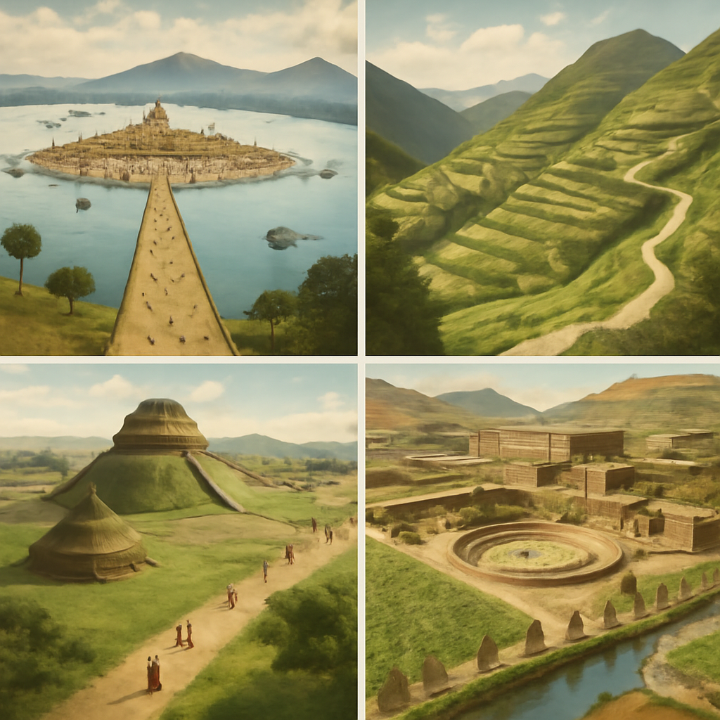
Olmec Centers Flourish
Olmec centers on the Gulf Coast developed monumental sculpture, ritual landscapes, and elite authority that influenced later Mesoamerican societies.
Classic Maya City-States Peak
Classic Maya cities flourished through dynastic politics, writing, astronomy, ritual kingship, art, warfare, and regional exchange.
Cahokia Rises
Cahokia expanded into the largest pre-Columbian urban center north of Mexico, with mounds, plazas, neighborhoods, and regional influence.
Tenochtitlan Founded
Mexica settlers founded Tenochtitlan on an island in Lake Texcoco, building the urban base for later Aztec imperial power.
Inca Expansion under Pachacuti
Pachacuti and his successors transformed the Inca polity around Cusco into a rapidly expanding Andean empire.
How to Think About It
Mesoamerica, the Andes, North America, and the Caribbean developed different systems.
Archaeology, inscriptions, landscapes, oral memory, and colonial records need to be read carefully.
Indigenous peoples and histories continued after conquest.
Urban centers, roads, plazas, mounds, and ritual landscapes made authority visible in different ways.
Fast Frame
Pre-Columbian civilizations is not a simple sequence of events. It is a way to compare power, geography, labor, memory, and evidence across cases that are often separated into national stories.
The phrase is useful only when it does not erase regional difference and Indigenous continuity. The useful question is not which case matters most, but what becomes visible when the cases are placed on the same route.
A reader arriving from search usually wants a quick answer, but quick answers become misleading when they hide structure. This page keeps the short answer near the top while giving enough route logic for causes, turning points, and afterlives to stay connected.
What Changes When the Route Is Connected
Connected reading keeps the atlas from turning history into isolated summaries. A conquest page needs an Indigenous state before it; an abolition page needs a forced-migration system behind it; a revolution page needs a post-independence state after it.
This structure also helps Google and readers understand that the canonical page is answering one broad intent. The page gathers related terms into a single route instead of splitting near-duplicate pages across the site.
The connected route also makes comparison fairer. Instead of asking one event to carry an entire civilization or region, the page lets several pages share the explanation: a hub for context, a timeline for order, event pages for detail, people pages for agency, and year pages for entry points.
Geography and Scale
Geography is not scenery in this route. Lakes, mountains, ports, islands, plantations, roads, deserts, courts, and capitals decide what kinds of power are practical. A state that can move labor through mountains faces a different problem from a state that depends on ships, forts, or treaty language.
Scale also changes the argument. A village, city, kingdom, empire, plantation zone, treaty system, and international conference do not work the same way. The page keeps moving between scales because historical causation often sits in the gap between local experience and large institutions.
That map-aware structure is useful for readers because dates become easier to remember when each one has a place, a route, and a material problem attached to it.
How to Read Evidence
The evidence changes across the route. Archaeology, inscriptions, oral memory, treaty language, court records, voyage databases, speeches, constitutions, photographs, and climate diplomacy do not produce the same kind of historical voice.
A strong answer keeps those source differences visible. The goal is not to flatten every case into the same pattern, but to let comparison reveal where the pattern breaks.
Official records often preserve the language of states, courts, and empires. Archaeology can show settlement, diet, labor, trade, and ritual without requiring written archives. Oral memory and public commemoration preserve meanings that formal documents often miss.
Actors and Affected Groups
The route keeps famous leaders in view without letting them take over the whole explanation. Rulers, rebels, diplomats, priests, captains, enslavers, merchants, and ministers mattered, but so did farmers, builders, enslaved families, island communities, students, workers, translators, migrants, and survivors.
This matters because many broad history pages become thin when they turn every change into a decision by one recognizable person. The route asks who had power, who carried costs, who interpreted events afterward, and who had to live inside institutions created by others.
A reader can therefore move from a named person to the larger structure around that person. Pachacuti makes Inca expansion easier to enter, but roads and labor systems explain how expansion worked. Liliuokalani makes Hawaiian sovereignty vivid, but land, law, diplomacy, and foreign residents explain why the overthrow mattered.
Causes, Triggers, and Afterlives
The page separates background causes from visible triggers. A battle, treaty, uprising, or law may be the moment people remember, but it usually depended on older pressures: land conflict, labor demand, fiscal strain, racial hierarchy, military technology, ecological risk, or imperial rivalry.
Afterlives matter as much as origins. Conquest created memory and resistance. Abolition created new labor struggles. Independence created state-building problems. Treaty disputes created modern legal and political debates. Climate diplomacy turned older colonial and environmental histories into present-day survival questions.
This cause-trigger-afterlife structure makes the route useful for essays and search answers. It gives the reader a way to answer why something happened, what happened next, and why the event still appears in public memory.
Common Misreadings
One common error is to read the route as inevitable. Conquest was not inevitable, abolition was not inevitable, independence was not inevitable, and reform was not inevitable. People made choices under constraints, and those choices interacted with disease, geography, military power, markets, and institutions.
Another error is to treat the region as empty before outside powers arrived. Indigenous America, the Pacific, and East Asia all had political systems, knowledge routes, and conflicts of their own. Atlantic slavery and Latin American independence also cannot be explained only from European capitals.
The page guards against those errors by giving readers several linked doors into the same subject. If one page feels too narrow, the timeline and hub widen the view; if the hub feels broad, the event and person pages make the argument concrete.
Reader Path
Begin with the hub, then open the timeline to see the order. Move into event pages for causes and consequences, people pages for agency, and year pages when a single date becomes an entry point.
The route is designed for students and curious readers who need a usable structure before they need specialist detail. Each next read answers a concrete question rather than sending the reader to a generic related list.
The best next click depends on the reader's question. A causes question belongs with an explainer or event page; a sequence question belongs with the timeline; a people question belongs with a biography; a broad study question belongs with the hub.
Why This Belongs in a World History Atlas
World history becomes thinner when the Americas, Pacific, slavery, and East Asia appear only when European powers arrive. These routes make older local systems, Indigenous sovereignty, coerced labor, state-building, and modern memory part of the main map.
The page also protects against a common reader-quality failure: a site can have many URLs but still feel shallow if each URL answers only one narrow fact. A comparison or explainer page can hold the larger question together.
The atlas becomes more useful when broad routes and detailed pages reinforce each other. The route gives structure; the individual pages give texture; the sources give readers a way to check the claim.
What the First Screen Must Answer
The first screen has to answer the search query without exhausting the subject. A useful answer names the core contrast, the time span, the geographic setting, and the reason the comparison matters. It also creates a reason to keep reading: there is a hidden structure beneath the familiar label, and the page will make that structure visible.
That opening promise matters for general readers. Many arrive with a school assignment, a half-remembered date, or a phrase from a video or book. They need confidence quickly, but they also need a route that does not collapse into trivia. The page therefore moves from fast answer to evidence, geography, actors, causes, consequences, and reading path.
The page avoids a common generic web-copy failure by refusing to summarize everything at the same temperature. Some details are anchors, some are turning points, some are examples, and some are caveats. Varying their weight makes the page feel guided rather than mechanically exhaustive.
How the Route Handles Uncertainty
Historical evidence is uneven. Some events have official texts, court records, parliamentary debates, or treaty documents. Others depend more heavily on archaeology, oral tradition, material culture, later chronicles, or contested memory. The page keeps that unevenness visible because confidence is part of historical explanation.
Uncertainty does not make the subject vague. It changes the kind of claim a careful page can make. A date may be approximate, a motive may be debated, a number may be an estimate, and a political meaning may differ across communities. Good structure lets the reader see the difference between a firm fact, an interpretation, and a public memory.
This is also a quality control rule for future content generation. A draft is not rich merely because it is long. It needs source-aware language, named places, concrete institutions, and clear limits on what the page knows. When a page cannot support a claim, the workflow goes back to sources or narrows the claim.
How This Page Connects to Deeper Study
The best use of the page is not a single read-through. A reader can use the comparison as a launch point: open the timeline for sequence, open event pages for causation, open people pages for agency, open year pages for chronology, and return to the hub when the larger route becomes blurry.
That pattern is deliberate. The structure stays visible: one main question, supporting examples, and descriptive anchors that name how each next page extends the problem. Internal links are not decoration; they are how the atlas lets a reader move from a broad claim into evidence.
The deeper-study path also keeps the route from becoming shallow. Each connected page has a job: one gives sequence, another gives causation, another gives a person or date, and another opens a broader regional frame. When the jobs are clear, the route feels guided rather than scattered.
Questions That Keep the Page Alive
A strong comparison ends with better questions than it began with. Who had power before the famous event? Which institutions made that power durable? Which groups paid the cost? What changed immediately, what changed slowly, and what remained unresolved? These questions turn a topic from a closed summary into a route for further reading.
The same questions keep the route consistent. Causes and consequences belong with events; chronological and regional structure belongs with hubs; turning points belong with timelines; constraints around individual agency belong with people pages. Without those questions, a large atlas can still feel thin.
A useful page makes a reader want the next click. The next click is not random related content. It is a continuation of the problem the page raised: a date that needs context, a person whose choices need constraints, a place whose geography shaped outcomes, or a later debate that keeps the past active.
Why the Term Needs Care
Pre-Columbian is a convenient classroom label, but it is also a label built around a European arrival. That can make thousands of years of Indigenous history sound like a preface to 1492. A better use of the term treats it as a doorway into societies that had their own chronologies, conflicts, inventions, migrations, alliances, and memories before sustained European contact.
The Americas were not a single cultural zone. Mesoamerican city-states, Maya dynastic courts, Mexica tribute networks, Andean highland states, Inca road administration, Mississippian mound centers, Chacoan great houses, Caribbean communities, Arctic adaptations, Amazonian landscapes, and many smaller polities developed different answers to environment and power. The page becomes clearer when each region is allowed to remain specific.
This also changes the moral frame. Indigenous societies were not valuable because they resembled Europe or because they can be ranked by monument size. They matter because people built durable worlds with agriculture, astronomy, trade, ritual, law, diplomacy, warfare, engineering, memory, and ecological knowledge under local conditions.
The label also hides time depth. The Olmec world, Classic Maya courts, Cahokia's peak, Chaco's great-house network, Mexica expansion, and Inca imperial growth did not happen at one moment. They belong to different centuries, climates, rivalries, and source problems. A reader gets a stronger answer by asking which society, which region, and which period before turning the phrase into one blanket category.
Cities, Landscapes, and Political Power
Urban life in the pre-Columbian Americas took many forms. Teotihuacan and Tenochtitlan invite questions about markets, lakes, neighborhoods, tribute, temples, and imperial expansion. Classic Maya cities invite questions about dynastic inscription, ritual display, drought stress, and competition among courts. Cahokia asks how plazas, mounds, woodhenges, river corridors, craft production, and regional gathering could create power north of Mexico.
The Andes show another pattern. Mountain geography made roads, storehouses, labor obligations, terrace agriculture, camelid caravans, and administrative nodes central to political life. The Inca did not govern by copying a Mesoamerican city model. They built power through vertical ecology, provincial management, ritual centers, and the ability to move labor and goods across difficult terrain.
Landscape is therefore evidence. A mound, road, terrace, plaza, canal, geoglyph, causeway, or abandoned room can show authority even when written records are absent or uneven. Archaeology does not simply fill gaps left by texts; it often asks different questions about diet, craft, climate, labor, settlement, and everyday life.
Evidence, Continuity, and Conquest
Some pre-Columbian societies left inscriptions, codices, monumental art, or later Indigenous-language texts. Others are known mainly through archaeology, oral tradition, environmental evidence, early colonial records, and community memory. That uneven record means careful writing has to distinguish firm dates from broad ranges, political claims from later colonial descriptions, and living Indigenous knowledge from outsider categories.
European conquest changed the archive. Spanish, Portuguese, French, English, and later national records often preserved Indigenous people through the language of taxation, conversion, labor, war, land, and administration. Those records can be useful, but they are not neutral windows. Reading them beside archaeology and Indigenous memory makes the page less dependent on conquerors' categories.
The page also needs a scale check. A carved monument, a household floor, a maize field, a burial, a road segment, a shell bead, and a colonial legal case answer different questions. Monumental evidence can make rulers visible; household and environmental evidence can make work, diet, migration, trade, and stress visible. Both scales are needed if the route is going to feel like history rather than a list of famous ruins.
This is why a useful reading path moves slowly from place to place. Tenochtitlan explains lake-city power, Cahokia explains mound-centered regional gathering, Chaco explains built landscapes and exchange, and the Andes explain road administration across vertical environments. Each case changes the answer to the same search question.
Continuity is the final guardrail. Maya, Nahua, Quechua, Aymara, Pueblo, Haudenosaunee, Mississippian-descended, Caribbean, Amazonian, and many other Indigenous histories did not disappear when conquest began. Pre-Columbian civilizations are living historical inheritances as well as past societies, so the next click leads from ancient cities into sovereignty, language, land, and memory.
That continuity also makes the evidence more responsible. A museum object, excavation report, colonial document, or textbook map does not replace living communities as if Indigenous history only exists in the past. The strongest route lets readers move from archaeological evidence to present questions about land, repatriation, language, sacred sites, and who has authority to interpret the past.
Map Layer
What Were Pre-Columbian Civilizations? map examples
Gold pins mark the approximate locations of published event pages. This is a schematic locator map, not a historical border map.
Coordinates are approximate and are used to help readers orient themselves before opening a full event page.
Examples
Events That Make the Pattern Visible
Olmec Centers Flourish
Olmec centers on the Gulf Coast developed monumental sculpture, ritual landscapes, and elite authority that influenced later Mesoamerican societies.
Classic Maya City-States Peak
Classic Maya cities flourished through dynastic politics, writing, astronomy, ritual kingship, art, warfare, and regional exchange.
Cahokia Rises
Cahokia expanded into the largest pre-Columbian urban center north of Mexico, with mounds, plazas, neighborhoods, and regional influence.
Tenochtitlan Founded
Mexica settlers founded Tenochtitlan on an island in Lake Texcoco, building the urban base for later Aztec imperial power.
Inca Expansion under Pachacuti
Pachacuti and his successors transformed the Inca polity around Cusco into a rapidly expanding Andean empire.
References
Where to Check the Facts
- Smithsonian National Museum of the American Indian: Native Knowledge 360Indigenous-centered educational reference for Native history, sovereignty, community knowledge, and public interpretation.
- Smithsonian NMAI: Haudenosaunee Guide for EducatorsCommunity-consulted educational reference for Haudenosaunee culture, history, continuity, and interpretation.
- Yale History: Ned Blackhawk, The Rediscovery of AmericaIndigenous historian's synthesis for centering Native peoples in broader American historical interpretation.
- Indigenous ChicagoCommunity-partnered public-history project for place-based Native history, maps, memory, and continuity.
- Encyclopaedia Britannica: Pre-Columbian civilizationsReference for pre-Columbian civilizations in Mesoamerica and the Andes before European conquest.
- Official UNESCO World Heritage Centre: Cahokia Mounds State Historic SiteReference for Cahokia as a major pre-Columbian settlement north of Mexico.
- Encyclopaedia Britannica: Mesoamerican civilizationReference for Mesoamerican chronology, cities, religion, trade, and political systems.
- Encyclopaedia Britannica: AztecReference for Aztec political expansion, Tenochtitlan, and the Triple Alliance.
- Encyclopaedia Britannica: IncaReference for Inca state formation, expansion, and Spanish conquest.
- Official UNESCO World Heritage Centre: Lines and Geoglyphs of Nasca and PalpaReference for the Nazca geoglyph landscape and its archaeological significance.